For many of us, it has gotten REALLY dry. As we head into the weekend, there are at least some rain chances. Tomorrow is the summertime 'popcorn' with hit-and-miss storms, but most staying dry. Sunday the storms will be much more widespread as a cold front comes our way. Hopefully, you'll get some rain at your house either Saturday or Sunday, as next week looks dry with just an early shower chance in the southeast on Monday giving us much more hope for water.

When we look at the data from the Kentucky Mesonet, almost all of us our well below where we should be for rainfall this month. Normally, we should have seen about 4 inches of rain by now in June. Most places are showing less than half that amount. It becomes a bigger problem when you remember how hot we've been, so we're also losing a lot of moisture from the soil and plants without replacing it. The only areas seeing close to normal June rains is running north of I-64 from Owen, Scott into Harrison counties.

Now it has been hot the last couple of days. We got into the 90-degree range Friday afternoon, but the humidity was low so the heat index was actually lower than the temperature. We're going to be getting back into the 90s Saturday afternoon around the Bluegrass.

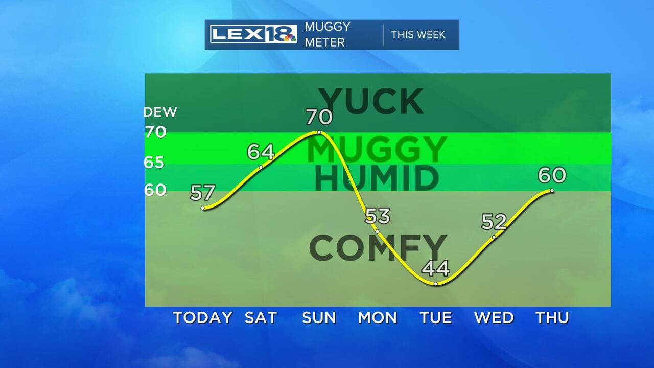
The low 90s tomorrow and Sunday will be accompanied by plenty of humidity, so the ol' Muggy Meter will be pegging into the uncomfortable range both Saturday and Sunday afternoon. As has been the pattern recently, The Muggies will be getting out of here again as more comfortable air arrives for the first of the week.


