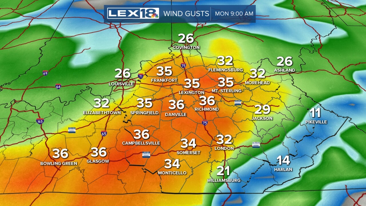
Another shot at strong thunderstorms is gliding our direction as we wrap up the weekend and begin a new work/school week. The whole week won't be awful, though. Tonight we have one line likely sweeping through beyond 2 am. This line could hold some very heavy rain and strong wind gusts. Showers may last through the morning before we dry for some time toward midday. Later in the afternoon, once the atmosphere warms and destabilizes, we will see more showers and storms developing ahead of the cold front.
The better chance for strong to severe action will sit east of I-75 for the most part, where the Slight Risk sits. Far eastern KY will be under an Enhanced risk for severe storms. The main threats with any storm will be damaging wind and torrential rain. Even not in storms, wind gusts may pick up and exceed 35 mph. We know some of these storms can lead to flash flooding, but we don't have a widespread threat for flooding this round. The action will last through Monday evening before wrapping up.
Tuesday looks to be the best day of the week, weather wise, as we see decreasing clouds and cooling temperatures (low 80s) along with lower humidity. Through mid and late week, we see the chance for rain and storms coming back with increasing heat.


