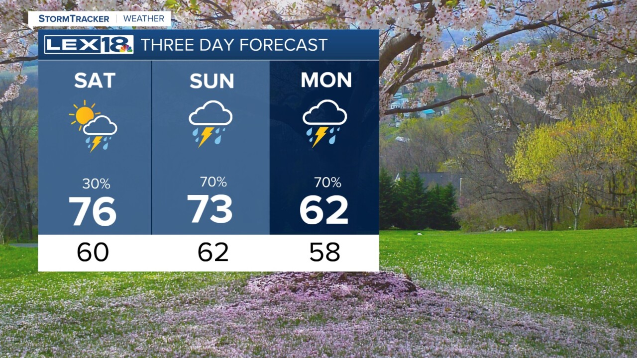
The spring warmth has really taken off today with high temperatures in the low 80s! The weekend will still be warm and breezy as we start to see some rain and thunderstorm action firing up later in the weekend. Tonight will be dry with lows around 60 degrees. Saturday should start quiet, but clouds will take over and give way to a shot at rain showers later in the afternoon/evening. These should not be severe, but we are watching for that potential on Sunday. The first wave will be Sunday morning and these look to be general thunderstorms. Strong to severe storms will develop overnight into Monday morning. Stay weather aware, these storms will be capable of producing damaging wind, large hail and isolated tornadoes. SPC has issued an enhanced/slight risk for severe storms Sunday. Rain will also be very heavy at times. The storm threat will rapidly diminish Monday afternoon with cooler highs in the 60s.
wlex


Posted
Copyright 2025 Scripps Media, Inc. All rights reserved. This material may not be published, broadcast, rewritten, or redistributed.
