HEAT ADVISORY continues tomorrow and Wednesday. The thermometer will be heading into record territory but just as important is the high amount of moisture in the air creating Heat Index values in the 103 to 110 range, which is getting into the danger category. When the Heat Index gets above 100, a lot of extra care needs to be taken outside. When it gets above 105 you really need to take it easy outside. When it pushes 108 to 110+ it's into the danger zone and finding ways to stay cool become imperative.

Many of the heat safety tips are commone sense, but it's always good to review. First, NEVER LEAVE A CHILD OR PET IN A CAR...not ever and not for any length of time when it's this hot. Temperatures in a car can hit a dangerous level remarkably quick. If you're going to be outside, stay hydrated and get into shady areas as often as possible. Avoid over exertion during the hot times of the day, so if you have to do something strenuous, aim for the early morning or the evening. Wear loose and light colored clothes to help your body deal with the heat.

The heat wave is covering most of the country, and this big heat ridge is not going to break down for us until next weekend. So even as the jet stream shows the heat centered on us Wednesday we'll see our temperatures peak then in the upper 90s. Record heat is a possibility both tomorrow, with a record of 94 and Wednesday with a record of 97.

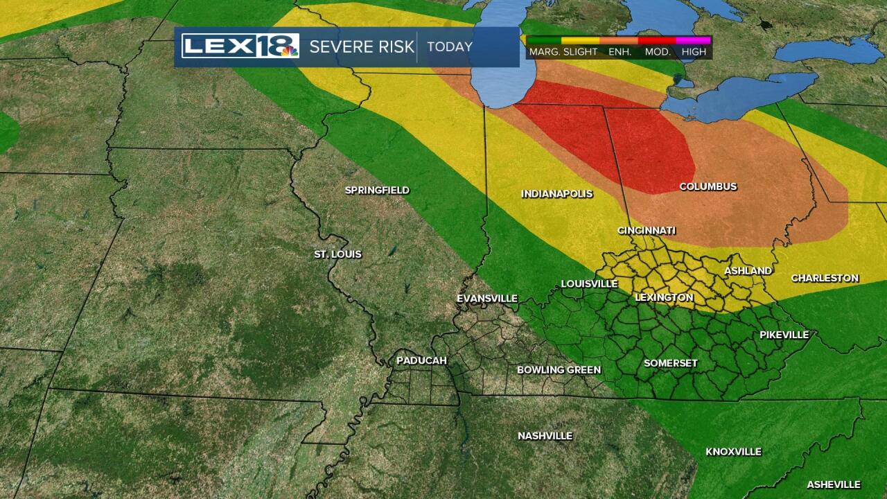
We have the heat and humidity, which can be high octane storm fuel. The Storm Prediction Center has highlighted the northern half of Kentucky in a slight risk of severe storms. The risk is greater to the north, but we'll watch the strong storm threat later today and evening.
This is the first wave of summer heat, and may not be the last as it's looking like the heat comes back next week. So we'll be saying this a lot, find ways to stay cool.


