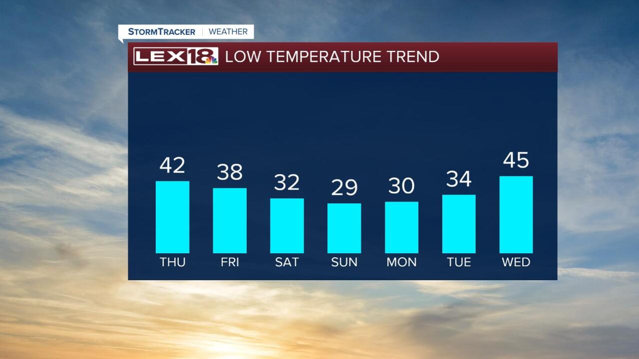
Active weather continues midweek. After morning showers diminish we'll catch a break in the action mid to late Wednesday morning. A cold front sliding east will spark an additional round of scattered showers and t-showers into the afternoon. Due to the timing, we'll see a narrow window for a few hours Wednesday afternoon where a few strong to severe storms (damaging wind ) will be possible, mainly from I-75 into eastern Kentucky. The higher threat will stay southeast and northeast of the Commonwealth. A marginal risk for severe storms remains in effect from I-75 east with a slight risk in effect for far eastern counties. Expect on and off waves of showers Thursday into Friday with another cold front setting us up for a big spring chill, highs in the 40s and lows on either side of freezing this weekend!


Posted
and last updated
Copyright 2022 Scripps Media, Inc. All rights reserved. This material may not be published, broadcast, rewritten, or redistributed.


