So far this week has been cooler than normal for mid-June. A whole new level of cool is about to blow in. It’s going to feel more like mid- to late-April with highs in the upper 60s tomorrow. Not the most ideal conditions for a day at the pool.
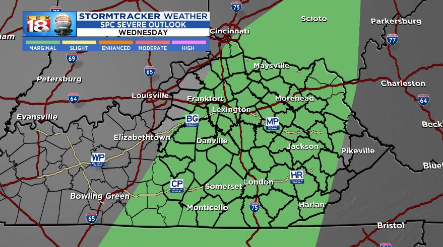
Things all get started with scattered thunderstorms late this afternoon into this evening. There is a “marginal” risk for severe weather across most of central and eastern Kentucky. A cold front will push through the Ohio Valley and carry the potential for isolated strong to borderline severe storms. Some large hail, damaging wind gusts, and locally heavy rain will be possible. Activity will wane as the night wears on.

After seeing highs in the 70s the past couple of afternoons, even cooler air will move in that will keep our temperatures in the 60s Thursday. It will be a very un-June-like day. The normal high tomorrow is 83 degrees. Lexington’s coldest high temperature for the day is 60 degrees from 1955.

The cold front won’t go through until tomorrow morning. Along with the unseasonably cool temperatures scattered showers will linger. When we’re not seeing a little rain, skies will be mostly cloudy. Conditions will improve by Friday. Sunshine returns and temperatures will rebound into the 70s during the afternoon. It will feel like summer once again this weekend, but it will also be getting stormy again.
