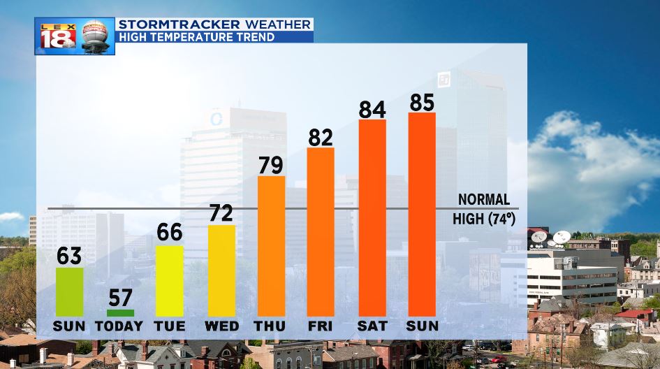
Things are about to change in a big way around here. The sun comes out tomorrow, and the heat builds through the weekend. The heat ridge that will travel east this week will warm us up, but also bring a small reprieve from severe weather for the Plains.
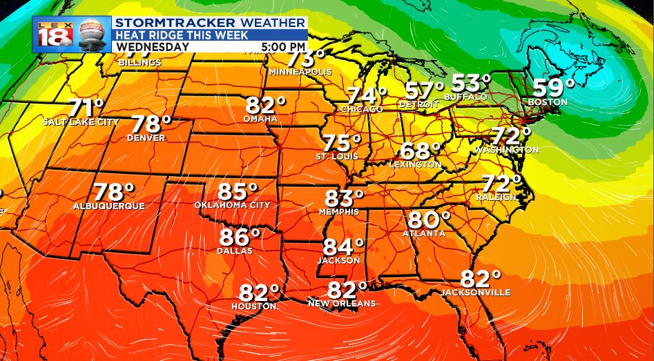
The ridge of warm and humid air is already warming the west coast. The higher-pressure slides into the Inter-mountain West and the Plains through midweek. This will do a couple of things for residents in these locations. First, the temperatures will warm into the low to mid-80s across the south. A few 80-degree temperatures will even be felt as far north as Nebraska and Missouri. During this time, we’ll be witnessing our warm up into the 70s.

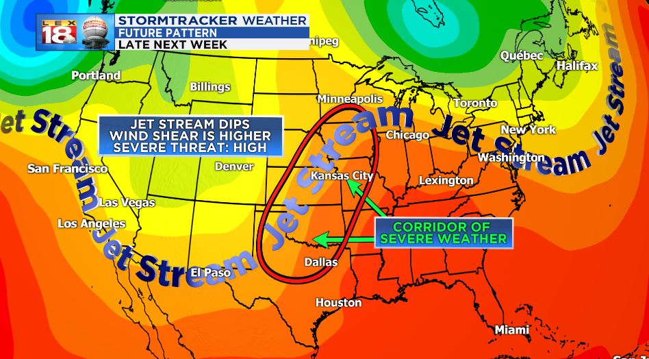
The second thing that this high-pressure ridge will do is deflect the jet stream up and away from the region, it sits over. When this happens, severe weather is limited. There are a lot of ingredients that go into a severe weather outbreak, but one of the most important is upper-level wind shear. Wind, turning and changing speeds with height helps build and rotate thunderstorms. When the faster-moving air aloft slows down, the wind shear factor is all but lost. That’s not to say that there still can’t be a chance for strong to severe storms. However, the likelihood of an outbreak is low.

The break from severe weather is short-lived for the plains, however. As the ridge slides east, another lobe of cool and dry air will slide south into the Plains. When this happens, the wind shear component returns along with the two different air masses nudging against each other. The weekend looks to bring the Plains another chance for severe weather.

As that occurs, we will be directly under the ridge, meaning we will be seeing the warmest air in the pattern, over the course of the weekend. Expect to be in the mid-80s both Saturday and Sunday.

*NOTE* – Banners lines in the graphics above that say “next week” are referring to this week.

