If you have some grass to cut, mulch to spread, flowers to plant, or something on the farm to do, today is your day. Starting tomorrow showers and thunderstorms return to the forecast and they will stick with us through the start of next week.
Following the soggy conditions around the Derby we will seen a nice run of days. The sun has been out and temperatures have been on the move. A warm front has already blown through. That’s what ushered in the “May heat” today with highs expected to climb into the mid 80s, which is more typical for the middle of summer. An approaching cold front will help to spark the rounds of storms over the coming days.
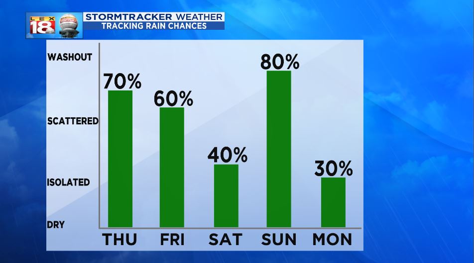
Thursday will be one of the more active days of the upcoming stretch. Things will get started with numerous showers and storms, especially during the afternoon and evening. The severe threat is low, but a few stronger storms with gusty winds and heavy rain are possible. The Storm Prediction Center has included the Bluegrass and areas west in the “slight”, while the rest of the area (eastern and southern counties) in the “marginal.”

The cycle won’t break any time real soon. Scattered thunderstorms will continue Friday. We will catch a bit of a break of Saturday. Any activity will be fairly isolated. Unfortunately chances will ramp back up on Mother’s Day as another low passes by.
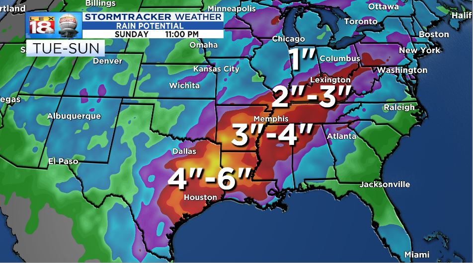
Two to three inches of rain could fall through the end of the weekend. Areas along and west of the Mississippi River are at the risk for receiving several inches of rain and flash flooding.
