At this point it’s almost become expected. There will be more rain this week. But this week’s event will be different. Some spots across the Commonwealth could receive a month’s worth of rain over five days.
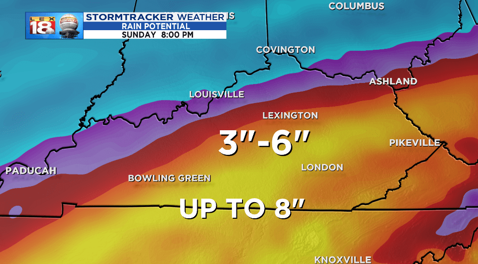
By next Sunday widespread rainfall totals of three to six inches are expected across the Commonwealth, with up to eight inches possible for parts of southern Kentucky. Repeated rounds of rain are in the forecast starting Tuesday morning. Here’s the set-up – multiple waves of low pressure will move along a stalled front to our northwest. Deep Gulf moisture will feed the multiple rounds of rain, which could be heavy at times.

The first wave is set to arrive Tuesday night. Rain will lift northward, and may even begin as snow or a wintry mix for the Bluegrass. Heavy rain will continue for everyone through Wednesday. South-central Kentucky could easily pick up two to three inches of rain just from this initial round. Localized flooding along with rises of rivers, creeks, and streams are possible.

Additional waves of rain are likely through the weekend. Everything will finally get shut down once the stalled front gets a move on as a cold front on Sunday. There will be very little time for the saturated ground and swollen water sources to recover. Each subsequent round of heavy rain will enhance the risk for flooding and further aggravate the river flooding situation.
Rises of the Cumberland and Kentucky rivers are likely. If you live near these river, or any other flood prone area, be aware that water levels will rise this week. Be prepared to take action if necessary. And remember to never drive through flood waters.
