It seems as if we just cant catch a break these days. Rain continues to dominate the forecast each week. As we enter another progressive pattern, showers are back on approach.

Rain will be the main form of precipitation this week, but we can’t rule out a few wintry mix showers at the onset of the moisture. A brief line of snow and freezing rain is moving north now and will cause a slippery road situation this morning. The good news is, the warmer air behind it will cause the rain to wash away any minor accumulation we are expecting. Still, this morning could be a little icy.

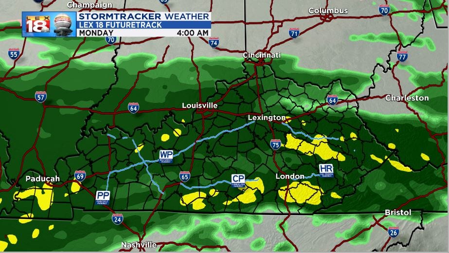
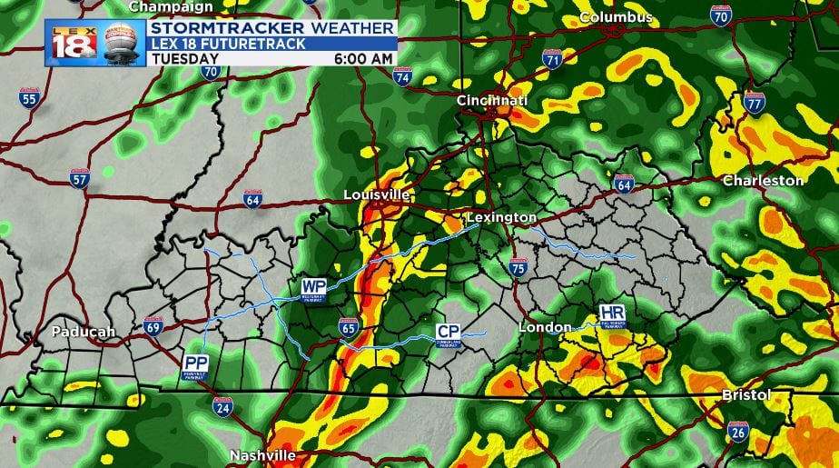
Once again, as temperatures warm above freezing rain will take over and it doesn’t seem to want to stop. Light to moderate swaths of rain will continue tonight and Monday. A strong cold front will ramp up the rain rates and even bring a few thunderstorms on a breezy Tuesday.
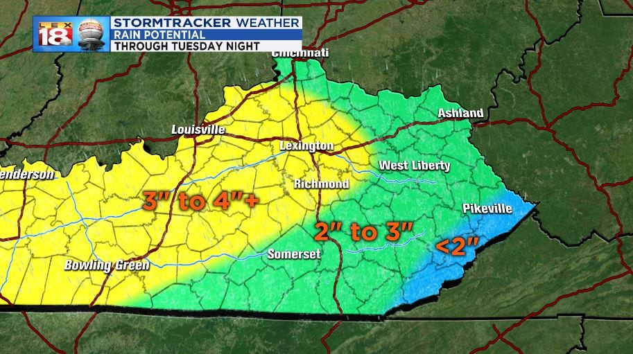
When it’s all sad and done, we’re expecting anywhere from 2” to 3” to fall in most locations around Kentucky. Localized amounts up to 4” are possible. The further southeast you live in Kentucky, the less rain you will receive.
A FLOOD WATCH has been issued and will take effect Sunday evening and last through Tuesday. Creeks, streams, and rivers are already swollen and will continue to rise with the rain and runoff through next week. High water is a likely scenario this week. Watch for water covering roads and find a different route if that’s the case where you’re driving. Remember to take it slow during heavy rains as ponding can cause hydroplaning.

Keep it with LEX 18 News for all of the latest updates and forecast for the upcoming rainy pattern. More information on the forecast can be found at www.lex18.com/weather
