Yesterday we were breaking records and feeling like spring. Today, welcome back to the Arctic. A strong cold front brought the sharp temperature drop. Between 3 PM Thursday and 9 AM this morning temperatures fell 49 degrees. Temperatures struggled to make it back to the freezing mark during the afternoon. That’s 40 degrees colder than yesterday!

We will keep the winter theme this weekend. With the Arctic air mass still in place and mostly clear overhead, temperatures will dive close to 10°, even the single digits Saturday morning. (Wind chills first thing Saturday will be near 0.) By the afternoon sunshine will “warm” us up into the mid 30s.
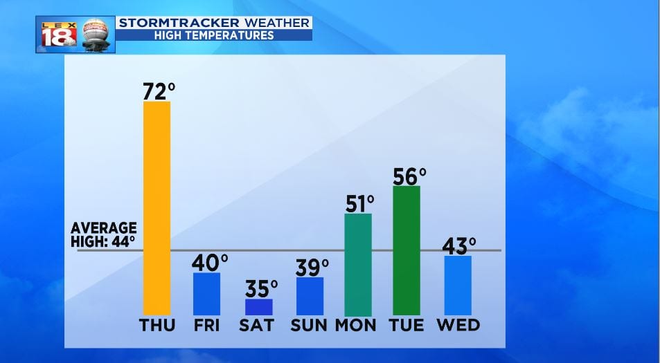
Temperatures will begin the surge early next week. The milder temperatures will also accompany for changes for rain. Our next soggy stretch will begin Sunday and continue through Tuesday. The beginning for this multi-round rain event could be a little interesting.
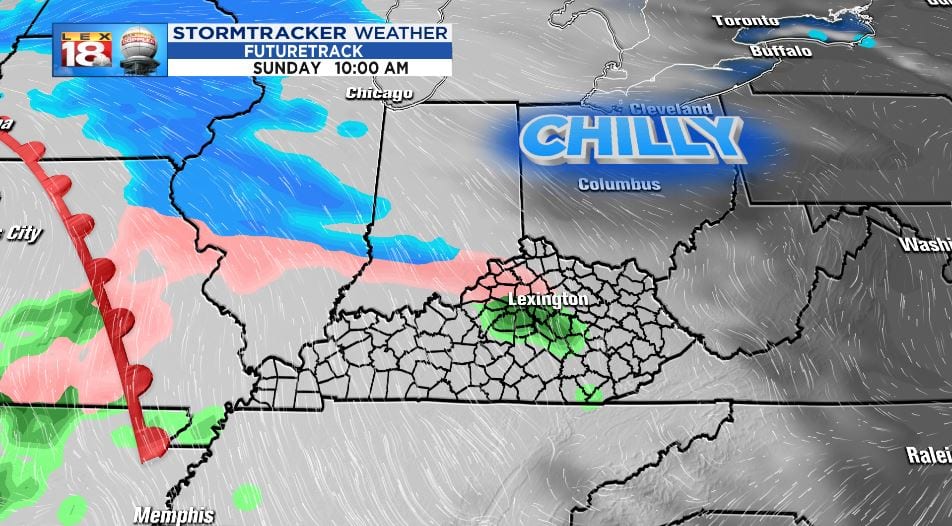
The Arctic will be on its way out Sunday morning. At the same time the precipitation is on its way in. We are tracking a brief period of wintry mix – possibly a slushy snow, sleet, and freezing rain. The wintry mix will quickly change over to rain by late Sunday. By Tuesday another two or more inches of rain could fall.
