A winter storm that stretches over 2,000 miles is bringing rain and wind to Kentucky. All day it’s been light rain or mist with pockets of moderate rain. Now, we’re tracking a squall line that will deliver a small punch of strong storms and wind.

Timing will bring the strongest of rain and wind to the Bluegrass and Central Kentucky by the evening tonight.
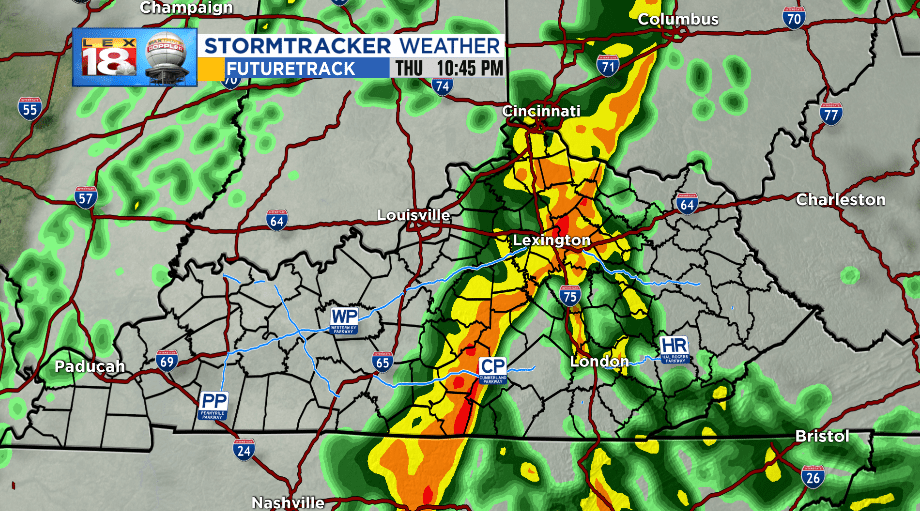
The front will progress eastward overnight and exit the southeastern counties tomorrow morning.

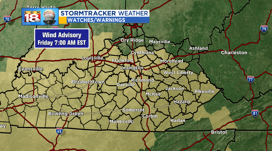
Most people in the state will be affected by the wind overnight. Strong southerly winds outside of the storms will gust between 30 and 50 mph.

This will make driving difficult, especially on west-east facing highways. Thunderstorm winds may get a little stronger at times. A WIND ADVISORY is in effect for most of Kentucky until 7am Friday morning.
The more dangerous effect of the storms tonight will be affecting a smaller percentage of the state. Flash flooding is possible in areas of the southeastern counties. Heavy rains and a brief frontal stall will lead to rainfall amounts ranging up to 2” area-wide and locally up to 3.”

A FLASH FLOOD WATCH will be in effect overnight and into Friday afternoon. High rainfall rates may lead to rapid stream, creek, and river rises. Also, previously saturated soil may come loose and cause mudslides, especially in steep areas. Remember to NEVER drive through a flooded roadway.

After tonight and tomorrow morning’s rain, conditions will improve as we move into the weekend. Temperatures will suffer a bit, but a nice weekend looks to be on tap.

