After a quieter start to week, the activity level is going to get ramped up looking ahead to the weekend. We are tracking a low to lift out of Texas and head straight through the heart of the Bluegrass. This round of active weather will be wet, instead of wintry.

The initial on-slot of rain will hold off until late Thursday night. The center of the storm will still be across eastern Texas, but a warm front will push widespread rain our way throughout Friday. Rain will remain off and on through Saturday night, possibly Sunday morning for some. Pockets of heavy rain and rumbles of thunder with be possible Friday night as the low grazes the Commonwealth.
 \
\
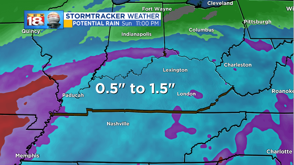
As mentioned above, the rain will be generally light over this two-day stretch. Around an inch of rain will be possible area-wide. Heavy rain and thunder will lead to locally higher amounts.

The upcoming round of rain will add to this year’s already historic amounts. Rain earlier this month broke the record for the wettest year. By year’s end Lexington’s total precipitation near seventy inches.
