It’s Winter Weather Awareness Week in Kentucky. We’ve had, and will have, some winter weather to be aware of this week. The Bluegrass is in a unique part of the country. A number of different types of winter systems can track through the area. Each type of winter storm has it’s own individual tracks and impacts.

Winter storms, no matter the type, tend to form where there are the greatest temperature contrasts. During the winter months the battleground areas are the the leeward (eastern side) Rockies and the western Gulf coast. Most of the low pressure systems that become big winter storms re-develop east of the Rocky Mountain. Kentucky is along the path of many of these winter storms.

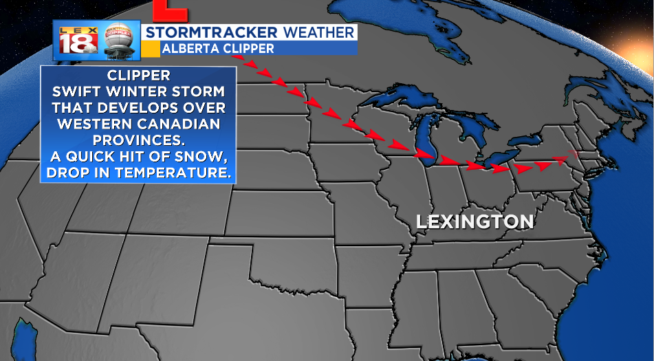
Alberta Clipper, Saskatchewan Screamer, Manitoba Mover. No matter the name these winter storms develop over the eastern Canadian Rockies then quickly track southward over the Midwest, Great Lakes, and Northeast. Clippers can track as far south as Kentucky. These types of systems carry limited amounts of moisture and move swiftly, so snowfall amounts are generally light. Clipper can also carry strong winds and usher in a drop in temperature.

A wide array of winter weather can come with Colorado lows. These systems enter the West Coast but dissipate over the Rockies.They get new live just on the other side of the mountains. Like clippers, these systems can develop over a number of areas like Colorado, the panhandles of Oklahoma and Texas, or western Kansas. The track, available moisture, and temperature profile all determine the type of wintry precipitation. Colorado lows can bring the Bluegrass heavy wet snow, sleet, ice, or a cold rain.

Depending on the size and proximity, Nor’easters can also bring snow to the Commonwealth. As the name suggests, Nor’easters track northeast along the eastern seaboard. These winter storms form a polar air over the land clashes with warmer air over the warm waters of the Gulf Stream. Heavy rain or snow falls closer to the center of the storm. Kentucky is often positioned on the northern fringe of Nor’easters. Higher snowfall amounts can be expected for southeastern counties.

