The snow this morning was a pretty sight to some, or a blatant reminder that winter is right around the corner. Wednesday will provide a break from the overly gloomy conditions, but we have more wintry weather to discuss.

Clouds will thicken through Wednesday afternoon before the next batch of precipitation arrives. Rain will begin out of the south as the storm system pushes northeast. Temperatures will be above freezing at this time, so the precipitation late Wednesday evening in the southern counties should only fall as rain.
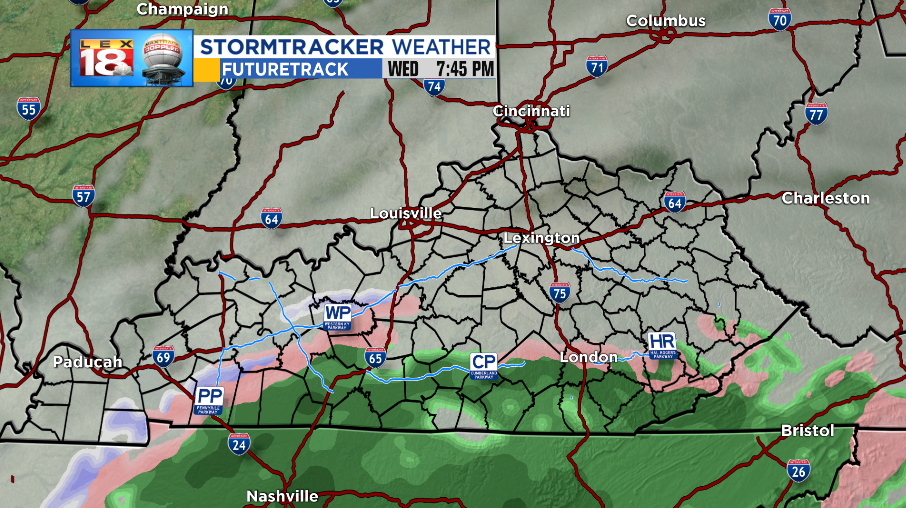
Temperatures will continue to fall as we progress into Thursday morning and will bottom out somewhere near freezing. This will allow a line of rain to transition over to freezing rain or a wintry mix as the line pushes northward.

Amounts of ice are expected to be minor, although the further north you are, the more you’ll experience. The highest amounts expected will be around 0.10” which will make things slippery for the Bluegrass and northern Ohio River Counties. Everyone south of Interstate 64 will be in mainly a cold rain.

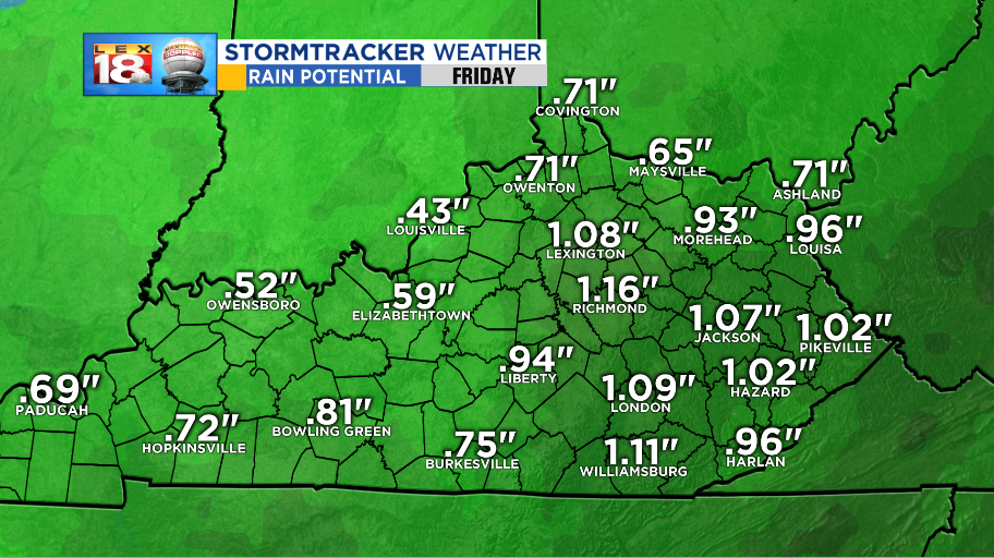
Rain amounts will be higher and run generally from 0.50” to about an inch and a half in areas that see the most.
As temperatures warm, after sunrise, the wintry mix will transition into rain for all and that will be the primary form of precipitation for the rest of the event. Rain moves out Friday morning and then the sun will be back out for the upcoming weekend.

This is a good time to remind everyone to download the FREE StormTracker Weather App in the Apple Store or in Google Play. The app has all you need to know to prepare for the winter weather expected.
Stay with the StormTracker Weather Team for the latest information and forecast updates. You can find more information on the LEX 18 Weather Page.
