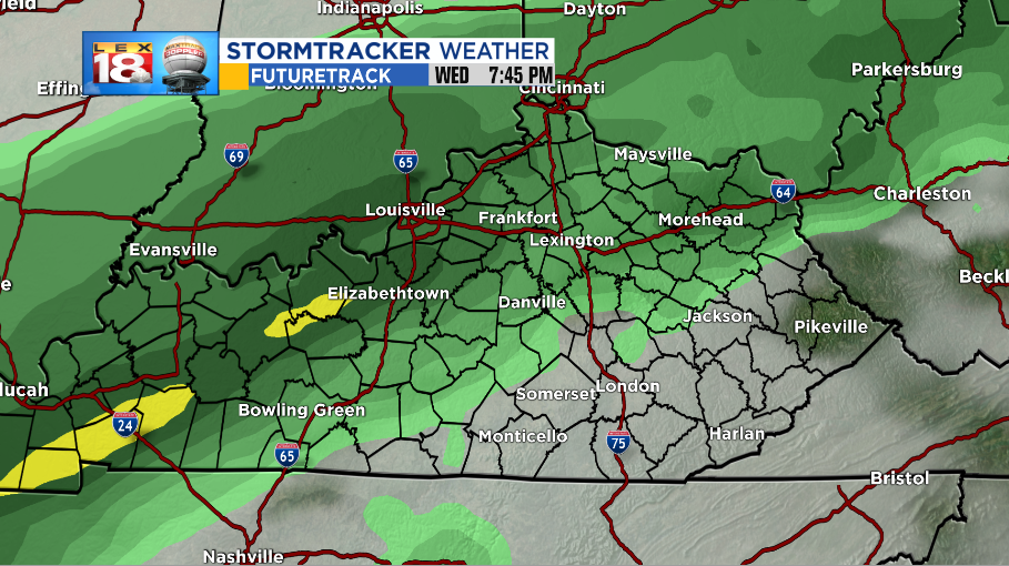
We’re tracking a couple of systems rolling through the Ohio River Valley this week that will bring loads of rain. Showers will start Wednesday afternoon and not wrap up until Friday.

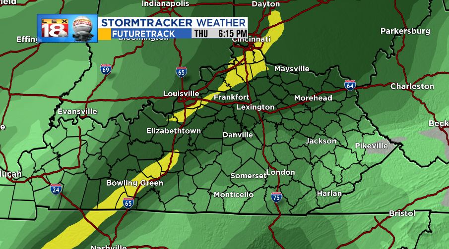
The first feature will be a col front that will sag far enough south to bring rain to the Ohio River, and as far southeast as the Bluegrass Counties. Instead of clearing the state as most fronts would do, this particular one will stall over the North and West Kentucky into Thursday.

At that time, a secondary low pressure center will move up from the Lower-Mississippi River Valley and ramp up the rain chances for everyone. Rain will continue, heavy at times through Thursday state-wide and we could be picking up a few inches of rain.

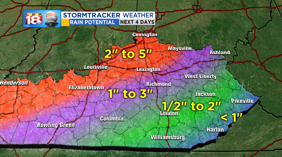
Rain amounts will run from less than an inch in the extreme southeastern counties up to around a half-foot for some along the Ohio River. Our Bluegrass and Northern Counties should end up between 2” to 5.”

A FLOOD WATCH will take effect Wednesday evening and last through Friday morning. Persistent rain mixed with heavy showers and storms may lead to high water especially in flood prone areas. Use caution and remember to NEVER drive through a flooded road.

Keep in mind, we’re already in 9th place for the wettest year on record. The next few days will only increase the 59” of rain we’ve already had and we’ll be closing in on the top spot.

