A Great Lakes low track keeps the Commonwealth mild, windy and wet Wednesday. Highs will stay in the upper 40s to low/mid 50s south. We will see much colder air crashing in with an overnight back end quick mix to snow transition but the bulk of our precipitation with this round will be rain.

Expect top end rainfall totals in the 1″ to 1.5″ range with localized flooding possible later in the day.

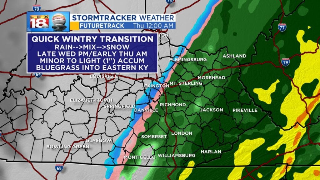
That cold air barrels in overnight- watch for a quick wintry hit late Wednesday night into early Thursday morning. There will be limited impact expected due to the speed of the changeover but a slushy shot of minor to light (1″) snow accumulation is possible from the Bluegrass into eastern counties. Higher elevations in the mountains will see slightly higher totals, 1″-2″.