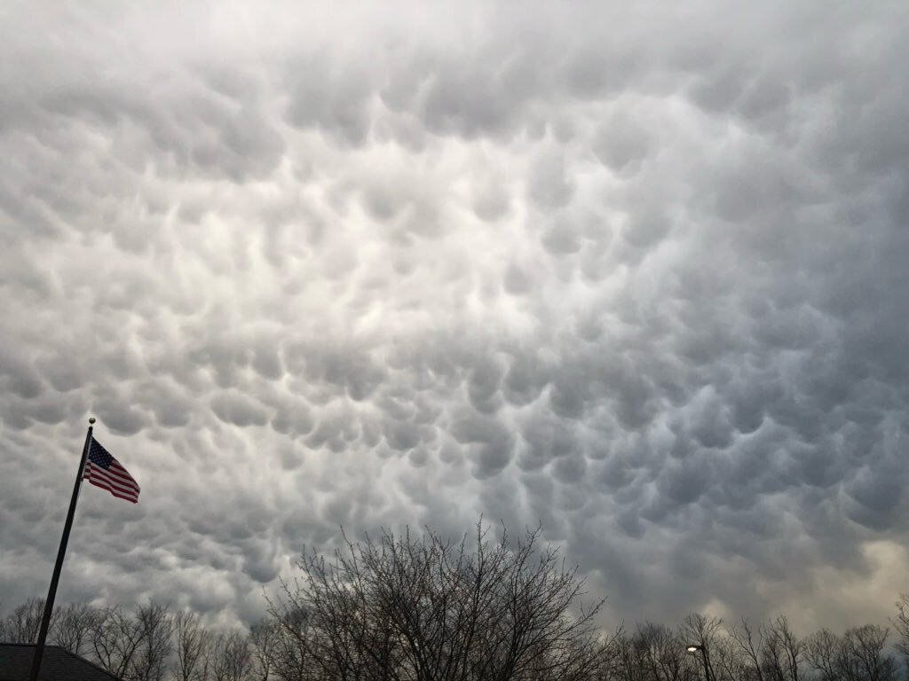
I had a number of sky watchers tweet me pictures this evening of the pouch-like clouds that they were seeing across the sky. They were mammatus clouds! These are one of my favorite clouds types. Mammatus are an unusual cloud type that forms in sinking air. Most clouds form in rising air and build upwards. You can think of mammatus clouds as upside-down clouds.
Mammatus clouds mostly frequently form on the underside of cumulonimbus clouds, the clouds that can produce severe storms. These were clouds were believed to be an indicator of severe weather or that a tornado was about to form. In fact, they are the opposite. Mammatus are often present after the worst of the severe weather has passed.

Mammatus can also form on cirrocumulus, altostratus, altocumulus, and stratocumulus clouds. To get things start there must be a source of sinking air. And the sinking air must be cooler than the surrounding air with a higher liquid water or ice content. The clouds will be long-lived if the sinking air contains large water drops or ice crystals, because it will require more energy to evaporate the large particles. The cloud will appear to grow downward, like you can see in this time lapse from Johnnie Nicholson in London. Over time the drops will evaporate and the mammatus will dissolve.
As mentioned above, mammatus clouds are often associated with severe weather. So why did they form this evening when only showers were on the radar? The answer isn't at the surface. It's in the middle and upper levels of the atmosphere. A weak trough is currently draped from the eastern Great Lakes through the Ohio Valley. Air in the middle and upper layers of the atmosphere is sinking. The air is also colder in those parts of the atmosphere. And the final piece, there is added moisture. The combination lead to the development of these protruding cloud structures. Pretty cool to see these atmospheric mechanics at play on a seemingly quiet weather day.


